In a Nutshell
Gauge: 2' 4½"
Length: Originally 8 1⁄4 miles of which 6½ was passenger. At present 0 miles
Opened: 1873 (horsedrawn) 1888 (steam freight) 1891 (steam passenger).
Location: Chirk and the Ceiriog Valley, North Wales
View Glyn Valley Tramway in a larger map
There are two preservation societies:
The Glyn Valley Tramway Trust
1 Mountain View,
Chirk Green Road,
Chirk,
Wrexham
LL14 5NR
Glyn Valley Railway Group
The Glyn Valley Tramway Group
The Old Tramway Engine Shed
New Road
Glyn Ceiriog
Llangollen
LL20 7HE
Dates of visits: 3 May 2012, 13 May 2012
Key Facts
- The line was built originally to transport the output from three granite quarries, two slate quarries, two chinastone quarries, a colliery and a silica quarry at Glyn Ceiriog to Chirk (mainline railway and canal)
- The original gauge of the railway was 2' 4¼" (half standard gauge) but this was changed to 2' 4½" when the railway was improved for steam traction (it is suggested that the locos used in the upgrade forced the rails further apart on curves)
- The railway ran for the majority of its length alongside a road
- Most of the original trackbed is still in existence
- The GVT Trust has gained planning permission to rebuild part of the railway at the Chirk end of the line (see above)
- The GVT Group has acquired the railway yard, coal yard at the Glyn Ceiriog end of the railway (see above)
Route
 |
| Source: Wikipedia - Dan Crow Date: November 6, 2006 (Licensed under Creative Commons) |
My Impressions
My first visit to the railway focused on the Glyn Ceiriog end of the railway. With a friend we investigated the former railway yard:
As can be seen, the original engine shed is still in situ (on the right) as is the station building (the single story building in the centre) which is now a private residence.

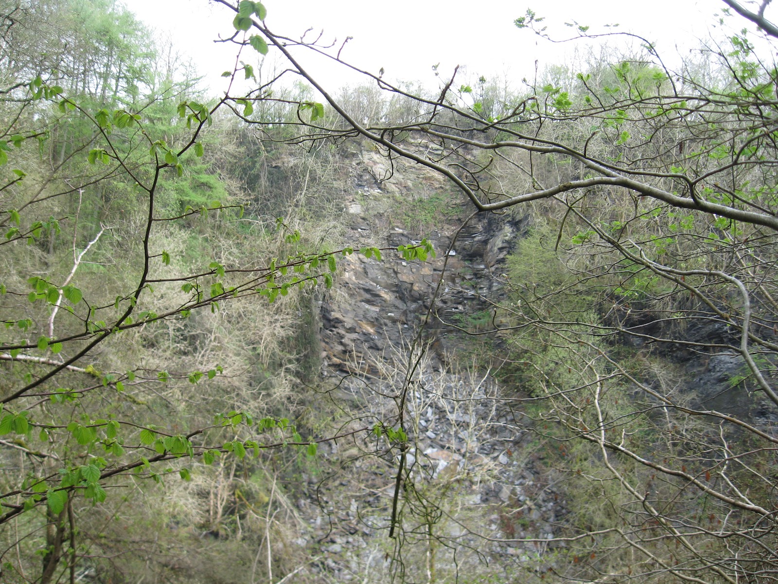
We then explored the slate quarries above Glyn Ceiriog which are now considerably overgrown with vegetation

From a vantage point above the village we got a good view of where the railway used to run. I've marked on this picture roughly the route of the old railway (click on the image to enlarge):

-------------------------------------------------------
I paid a second visit on 13th May 2012. On this occasion, I started at Chirk Railway Station and worked my way up the valley to Glyn Ceiriog, trying to spot locations depicted in some of the archive photos of the railway.


The GVT station at Chirk ran parallel to the mainline station sharing the same platform. The platform shelter on the modern station is in a similar position to the original GVT station building. Now, mature trees cover the ground once occupied by the GVT sidings. However, apart from the trees the ground is clear and ready for renovation.


Looking back towards the bridge from which the previous pictures were taken, this shot shows the GVT station shortly after closure. Today, the GVT bridge is still intact if somewhat filled with soil. It wasn't possible to take a picture from exactly the same spot as trees now mask the view.


After the bridge the line curves to the right and starts the descent towards the Ceiriog Valley, running parallel with the road. These two shots were taken at the same spot, firstly looking up the gradient and then down. The GVT Trust has begun to clear the trackbed, having been granted planning permission to commence restoration of the line.


Towards the bottom of the grade, the railway ran alongside the road, raised above it on a stone wall. In the archive photo the line and the road appear to curve to the left. I couldn't figure out where exactly this was, as the extant wall appeared to be straight and if anything, curved to the right. This shot was taken roughly where I assume the original to have been taken (but I am willing to be corrected).

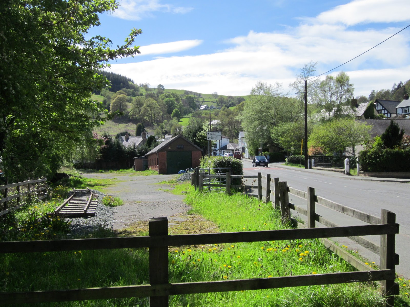
 Eventually, the railway descended to the level of the roadway on the valley floor and immediately crossed the road. On the day I visited this spot one of the volunteers for the GVT Trust was strimming the undergrowth, presumably in preparation for clearing the trackbed ready for tracklaying (here's hoping!).

The same scene viewed from the opposite direction. On the left, you can just make out the siding running alongside the road. This was used to enable trains to be split if they were too heavy to be pulled up the bank. From the map of the line it looks as if this would also have been a remnant of the branch which led to the Shropshire Union Canal in the horse-drawn days of the railway.


About a half a mile further up the valley, this postcard shows how the railway ran alongside the road for much of its length. In today's image, road widening has encroached on the site of the trackbed and a few more trees have taken over. However, it would be easy to imagine how road and railway could still co-exist.


After passing through Pontfadog, the line crossed the road a couple of times before reaching the village of Dolywern. At this point, the road curves abruptly to the left to cross the River Ceiriog on a stone bridge. Originally, in its horse-drawn days, the railway followed the road but when steam locos were introduced the corner was cut and the railway left the roadside .........


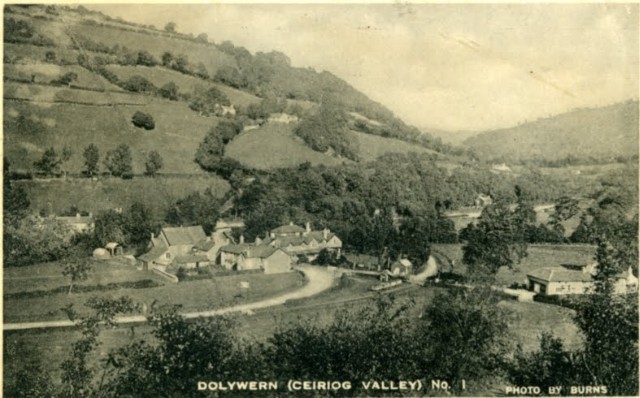
The archive postcard shows the station in the centre of the picture with the station building just behind the row of wagons and the road curving back to cross the bridge.

About a mile further down the valley, the line entered Glyn Ceiriog with the station alongside the road in the centre of the village. The station yard and loco shed have been acquired by the GVT Group which is intending to open a visitors' centre. As can be seen, a short length of 2' 4.5" gauge track has been laid in the same position as the siding in the above photo.


Looking back up the line from beside the loco shed, a train is just pulling away from the station (though the locos usually travelled cab-first as befits a tramway - being turned on the turntable on the line leading to the loco shed). The track on the left continued to a small goods yard beside the main square in the village and linked to the branch line which served the Wynn and Cambrian Slate Quarries above the village. The line on the right continued through the station to a coal yard and then on to the granite quarries further up the valley at Pandy and Hendre.

 These two archive shots of the village show the station in the middle distance and the Wynne slate quarry on the hillside above (see http://nwex.co.uk/showthread.php?p=137064). The engine shed is clearly visible and the station building can just be made out behind the coaches. The station building is still in existence but is now a private residence. The later view on the right shows further development though the station building is still just visible.

These two shots have been taken from roughly the some position on the Selattyn Road. The station building is on the right in the middle distance on the archive photo but is hidden behind the trees in the contemporary photo - however the roof of the engine shed can be seen. The fir tree shown in the archive photo has grown quite considerably and the saplings beside the river have now grown into mature trees.
Summary
I have thoroughly enjoyed my expeditions to the Glyn Valley and intend to explore the the line more fully in the future. I want to discover exactly where the line went in relation to the road and try to determine exactly where all the archive photos (aparently there are at least 350 in existence) were shot. I plan revisit the valley to log progress with the preservation groups' activities.All I can say is that the Ceiriog Valley is a hidden gem and is well worth visiting - with the added bonus for railway enthusiasts of trying to accurately plot the route of the original railway.
Video
Video report about the re-opening of the GVT from BBC WalesTo be continued ..............................
2' 4 1/2" is a very unusual gauge.
ReplyDelete