Search This Blog

Showing posts with label three foot. Show all posts

Wednesday, 11 September 2013

Southend Pier Railway

In a nutshell

Gauge:          3'

Length:        1.34 miles

Opened:      1851 - Horsedrawn tramway
                     1890 - 1978 - Electric railway (3'6" gauge)
                     1986 - Diesel railway (3' gauge)                  

Location:    


View Narrow Gauge Railways in a larger map  


Date of visit:     9 September 2013


Key Facts

  • The first pier at Southend was built in 1830 and in 1851 a horsedrawn tramway was added to take passengers to and from the jetty at the end of the pier.
  • The original wooden pier was replaced in 1888 by the existing pier which is still the longest in the world at 1.34 miles
  • In 1891, a 3'6" gauge railway was completed, operated by electrically powered toast-rack coaches (two of which were transferred in 1950 to the Volks Electric Railway in Brighton)
  • By 1930, the line had been doubled along its entire length and was operated by four seven-coach trains
  • In 1949 the rolling stock was replaced with four new seven coach trains similar to those on the London Underground. Each train comprised three motor cars and four trailer cars which could carry up to 260 passengers, at a top speed of 18 mph.
  • This 3'6" gauge electric powered railway was closed in 1978
  • It was rebuilt as a single 3' gauge line with a midway passing place and two Deutz engined, diesel-hydraulic powered trains and re-opened in 1986
  • The railway runs throughout the year (apart from Christmas Day - or if the weather is exceptionally bad).


Route


My Impressions

The last time I travelled on the Southend Pier Railway was approximately 50 years ago, when it was still electrically operated. I still remember the distinctive clack-clack-clack of the trains which could be heard all along the sea-front.

On this occasion, when we reached Southend sea-front, the rain was beating down and the end of the pier was only just discernible through the haze.

I made my way to the main entrance to the pier and duly paid over £4.00 for a return ticket. Despite the weather the train was still running at half-hourly intervals and so before long the regular beat of the wheels and a quick toot on the horn announced the arrival of our train. It pulled into the platform and we waited behind the barrier until the passengers from the pier-head had disembarked. We were then allowed on to the platform to board the train.

There are two platforms, but as only one train was running today, the other (Sir John Betjemen) was parked in the other bay.

The coaches are utilitarian, being finished inside with wipe-clean glass fibre panels.

The turn-round time is fairly brief and so, before long, we were on our way. The view from the carriage window on this wet September day was not particularly edifying, .......

......... but within ten minutes the head of the pier came into view.

We disembarked and made our way up the platform,......

...... with the skyline of Southend, visible in the distance, about a mile away.

There was time to admire the diesel loco and peer through the louvres at the Deutz diesel engine.
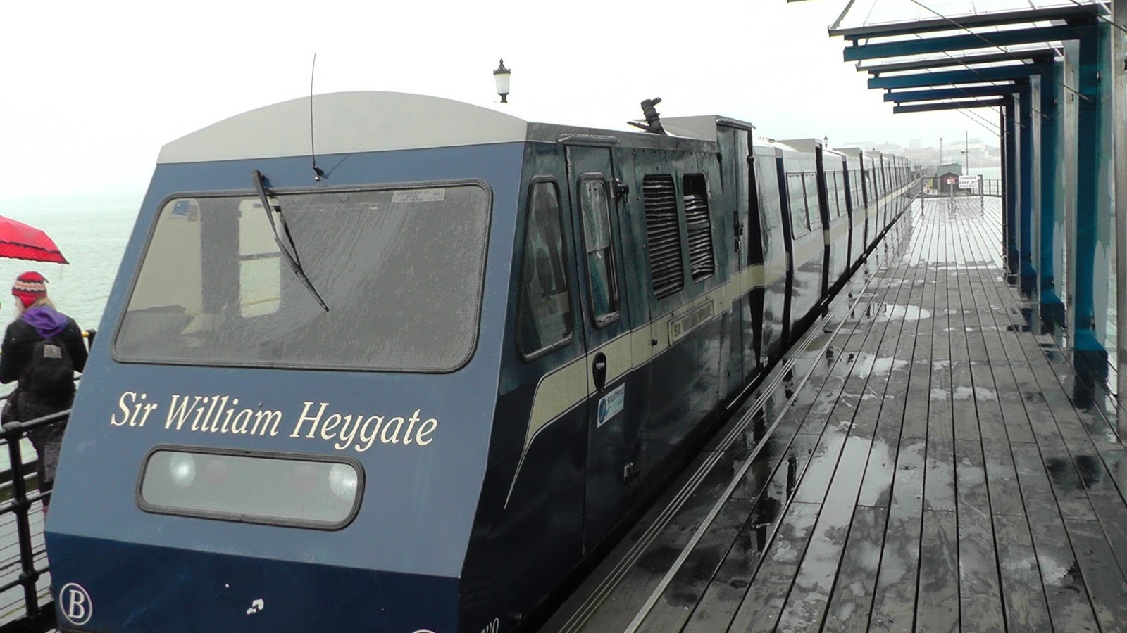
Despite the weather, I ventured to the head of the pier and then sought refuge in the cafe, availing myself of a cup of coffee and peering out along the pier to check on the progress of the train as it made its way back up towards us.

Eventually (about 25 minutes later), the train pulled back into the platform and we made our way to the carriages.

The driver's compartment was neatly laid-out and businesslike - though the persistent rain made conditions for photography less than perfect!

The line stretched back towards the mainland. If the weather had been more conducive, I would have walked back, catching a few lineside shots on the way. However, the rain was relentless and I decided that maybe discretion was the better part of valour - and rode back.

When we arrived back at the main (Shore) station, I checked out the two power cars of the line's trains ........

....... before making my way through the amusement arcade and out on to the seafront.

The railway has been constructed for a particular purpose and so its trains are designed to make life easy for the staff and appropriate for the passengers. On the journey, I caught a glimpse of the battery-powered car which is used during the winter months, parked on the other line at the Shore Terminus. The line also owns a couple of flat trucks which are used for maintenance and to transport items to the pierhead but these were not in evidence during my visit.

The museum was not open on the day I visited and so I was unable to see one of the 1949 coaches which it holds, but there are plenty of images of these on the internet.
Southend Pier - 1949 electric train-set - Source: http://i206.photobucket.com/albums/bb303/piermaster/Southend%20Pier%20Railway/00301949trainalongpier.jpg
By coincidence, I travelled on the Volks Electric Railway in Brighton the following day, seeing one of the original former Southend Pier power cars.

Maybe, one day I will return when the sun is shining and get a few lineside shots of the train in action. But I have now filled the gap of a 50 year absence.

Video

[In preparation] 


Monday, 8 April 2013

Rye and Camber Tramway

In a nutshell

Gauge:        3'

Length:      Approx. 1¾ miles

Opened:     Saturday 13 July 1895
Closed:  
     1939 (Outbreak of WWII)

Location:  


View Narrow gauge railways Britain & Ireland (closed) in a larger map


Web:   http://www.hfstephens-museum.org.uk/colonel-stephens-railways/rye-and-camber-tramway.html


 Dates of visit: 4 April and 6 April 2013

Key Facts

  • The railway was engineered by Holman F Stephens (Lt. Colonel Stephens) who later became well known for being responsible for several Light Railways across the country - Including the Kent & East Sussex Railway which has a museum charting his exploits.
  • It was called a 'tramway' because it was built entirely on private land and so at the time did not need an Act of Parliament. The Light Railways Act came into force the year after it was opened and so, had it been built then it would have been called a Light Railway.
  • The railway was originally set up to transport golfers to the newly opened Camber golf club.
  • At first the railway terminated at what later became Golf Links Station. The line was extended in 1908 to Camber Sands to accommodate the increase in day tripper traffic - although the station was still about ½mile from Camber itself
  • The railway had two 2-4-0 steam locomotives - Camber and Victoria, both constructed by Bagnalls of Stafford.
  • The railway had two bogie passenger coaches and two open wagons which could be converted to carry passengers as needed
  • In 1925, the railway acquired an 0-4-0 Simplex petrol powered locomotive. Victoria was sold and Camber was used only on very rare occasions
  • In 1939 Camber Sands station was moved to a new location to permit improvements to the golf course. However, the railway closed to passenger transport shortly afterwards and, although the Admiralty made some use of the railway, including concreting over part of the trackbed near the Golf Links Station, but after the war the railway was in such poor condition it was closed completely.
  • Although much of the trackbed is still visible, the extraction of shingle between Broadwater Bridge and Halfway House has resulted in a large lagoon where this part of the railway once ran.


Route

The Route of the Rye & Camber Tramway - Source: http://www.hfstephens-museum.org.uk/images/stories/railways/ryecam/02_ryecam.jpg
 

My Impressions

My first encounter with the railway was on a bitterly cold day in April when I parked the car beside the bridge over the River Rother in Rye and walked the footpath to the lagoon.

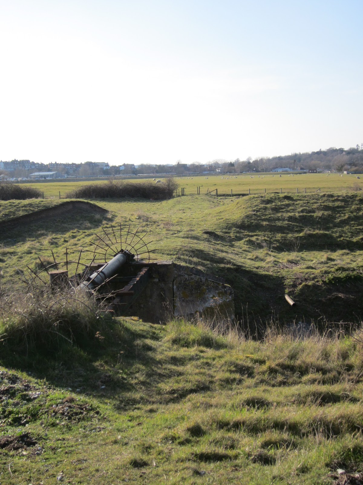
The site of the station beside the Monkbretton bridge is indistinct but the line of the railway across the meadow from the station towards Camber is clearly visible.
Rye Station with the abutments of Monkbretton Bridge in the background - Source http://www.hfstephens-museum.org.uk/images/stories/topics/camber_tramway/tram_b.jpg
The site of Rye Station
The Rye & Camber Tramway track across the meadow


A brisk walk across the meadow along the footpath/cycle track and we reached the Broadwater Stream which was crossed by the railway on a simple girder bridge.
Broadwater Bridge with a train bound for Rye - Source: http://www.hfstephens-museum.org.uk/images/stories/topics/camber_tramway/tram_j.jpg
Broadwater Bridge today

Looking back towards Rye, it is possible to make out the embankment leading up to the bridge and the route of the railway across the field.
Broadwater Bridge looking back towards Rye
At this point the route of the railway is interrupted by a lagoon formed by flooding the shingle workings at Northpoint Beach - it is now used for windsurfing.
The flooded shingle workings covering the old trackbed of the railway.
Although it would be possible to walk beside the lagoon towards Camber, we re-traced our steps hopped in the car to Camber, where we attempted to trace the route of the railway from the opposite direction.
The trackbed as it emerges from beside Gorse Cottage.
With the lagoon and Rye in the background the railway emerges once more by Gorse Cottage. It is now embedded in concrete which was laid by the Admiralty during the Second World War. On the right of this picture would have been Golf View which was demolished in 1983.
Golf View (aka Beachlands and Squatters' Right) with a Rye Bound train - Source: http://www.hfstephens-museum.org.uk/images/stories/topics/camber_tramway/tram_d.jpg
Turning around to look towards Camber, the trackbed now forms the roadway to Rye Harbour - but in places the rails are still visible.
The trackbed looking towards the site of Golf View - Golf Links station in the distance
The trackbed beside the site of Golf View - looking towards Golf Links Station
At the end of the road lies the slightly extended and modified station building and platform for Golf Links station which is presently in use by the golf club as a store room.
Golf Links Station building and platform with the concreted trackbed.
Golf Links Station in its days as the Camber terminus - Source: http://www.urban75.org/railway/images/camber02.jpg
The track is very much in evidence preserved in the Admiralty's concrete. Looking back towards Rye it's possible to imagine the train snaking its way beside the golf course to the station.
The trackbed looking back towards Rye from just outside Golf Links Station
The Simplex Railmotor hauls a packed train between Rye and Golf Links in 1931 - Source: http://www.hfstephens-museum.org.uk/images/stories/topics/camber_tramway/tram_n.jpg
Golf Links Station building from the jetty. The Golf Club buildings in the background
Although the course of the river has changed slightly and the golf course has been extended beyond the railway into what was once salt marshes, the station building is still quite close the the harbour and the newly built harbour master's house.
Golf Links Station during WWII when the Admiralty built a siding to a jetty - Source: http://www.colonelstephenssociety.co.uk/R&C%20E.jpg-for-web-large.jpg

On the day we were there, builders had taken over part of the former station yard and so not all was accessible - however, this looked to be a temporary intrusion.

The golf course has commandeered the trackbed immediately after the station but within a short distance there is a gateway to a permissive footpath across the golf course on the trackbed of the railway. This photo was taken looking back towards the Golf Links station, the harbour master's house is quite an impressive structure in the middle distance, dwarfing the old station building to its right.
Looking back towards Golf Links Station. The Harbour Master's house dwarfing the station building to its right
Looking the opposite way, towards Camber Sands Station, after curving to the left the track strikes out in a straight line on a low embankment. On the right would have been saltmarshes in the days of the railway, the embankment being washed by high tides. To the right in the middle distance the original trackbed branches off towards the pre 1939 terminus.
Looking towards the second Camber Sands Station - the original trackbed veered off to the left in the middle distance.
An early train with all coaching stock pressed into service among the marram grass near Camber Sands Station - Source: http://www.colonelstephenssociety.co.uk/COL-RCT1.jpg-for-web-large.jpg
The footpath follows the 1939 deviation to the second, short-lived Camber Sands Station. There is very little to show nowadays, apart from a widening of the trackbed to accommodate the wooden platform and shelter.
The site of the second Camber Sands Station


The original Camber Sands Station with the tea rooms in the background - Source: http://www.colonelstephenssociety.co.uk/Camber%20sands%201924.jpg-for-web-large.jpg
Camber Sands Station looking towards Golf View and Rye - Source: http://www.hfstephens-museum.org.uk/images/stories/topics/camber_tramway/tram_l.jpg
Camber Sands - Source: https://encrypted-tbn3.gstatic.com/images?q=tbn:ANd9GcRkfDfyebsN38vl2CTuVkI5YINPCWkEnRIL-LffM3WflgRAyG2p

 There is very little in evidence now of the original structure but searching among the 'rough' beside the trackbed unearthed the remains of a wooden post - which might well have been one of the supports for the wooden platform.
Camber Sands Station (1939 site) looking back towards Golf View and Rye. The remains of a wooden post just visible in the foreground.

Access

Most of the railway trackbed is still accessible. There is a small parking area beside the Monkbretton Bridge on the way out of Rye towards Camber. The footpath starts here beside the site of the station.
Site of Rye Station beside the bridge

View from the bridge - the trackbed is just discernible stretching out across the field from beside the Pumping Station.


It is possible to walk or cycle from here to Camber following the trackbed for much of the way.

Another access point is on the Camber Road, just where it takes a sharp left turn to run beside the lagoon. There is a parking area on the bend where the cycle track crosses the road. A short walk down the cycle track will take you to the remains of the Broadwater Bridge.
The remains of the Broadwater Bridge snapped from the footpath.
The best approach to the railway from Camber is to park in the Camber West car park and take the footpath to beach from the Westernmost end  of the car park (near to a row of cottages). The permissive footpath across the golf course on the trackbed can be accessed about half way along this path on the right hand side. The car park fee is quite pricey but you can walk the remaining section of the railway to the lagoon and back again in two hours.

Alternatively, you can park on the main beach car park and walk along the sands. Take the path into the dunes beside the 'Red Zone B' signboard and you will come to the start of the permissive path across the golf course (this time on the left hand side about half way along).